GeoPort - Astrocartography in Astrology. Galaxy.GeoPort astrological program
 Live - well, and live well - even better, as would say one of our favorite characters. And he is very right. I will allow myself one more free paraphrase: "Life must be lived there, that was not painfully ashamed of wasted years." Of course, Nikolai Ostrovsky mean "SO", but, in this case, "There" is more appropriate, because our will to choose the place where we were, quite possibly, will be much more comfortable than at home. Trying to change your Horoscope - empty fun, because it is not given to everyone, but to choose a place where to live, by any forces. It would be a desire, and sometimes a great desire. Nevertheless, in astrology there is a methodology, which allows to find a place where people will feel more comfortable and be able to express and realize themselves. To do this, and this is astrological program.
Features astrological program
- Live and powerful mapping, which allows to find not only the locality, but also the house.
- Display favorable regions, not only the conjunction lines.
- A wide range of map sets.
- Ability to instantly assess your chart for a new place.
- Built-in coordinate point mechanism.
- The original method of forecasting events.
- Integration program with all the Galaxy program.
Additional information about program
- Functionality of program
- Screenshots and brief description
- System requirements to program
- Load (download) resources
- Frequently asked Questions
- Project participants depending on personal contribution
- Program cost
- Prices
Functionality of program
| Operation mode |
|
| Astrological tools for forecasting and analysis |
|
| Groups of used maps |
|
| Supported house systems | 24 house systems, including - 14 of the most common and 10 modern |
| Zodiac system | Tropical |
| Work with objects |
|
| Support schemes for including objects in charts |
|
| Loading and saving charts | work with unlimited number of databases and unlimited structure of bank |
| Support time points | unlimited number of time points |
| Calculation of time correction | Considering alternative recourses |
| Directory of populated places coordinates | More than 16 ths populated places (in Locator program) around the globe |
| Protect of charts | Chart data protection against accidental change |
Screenshots and brief description
To view large pictures, please, mouse click on picture.
|
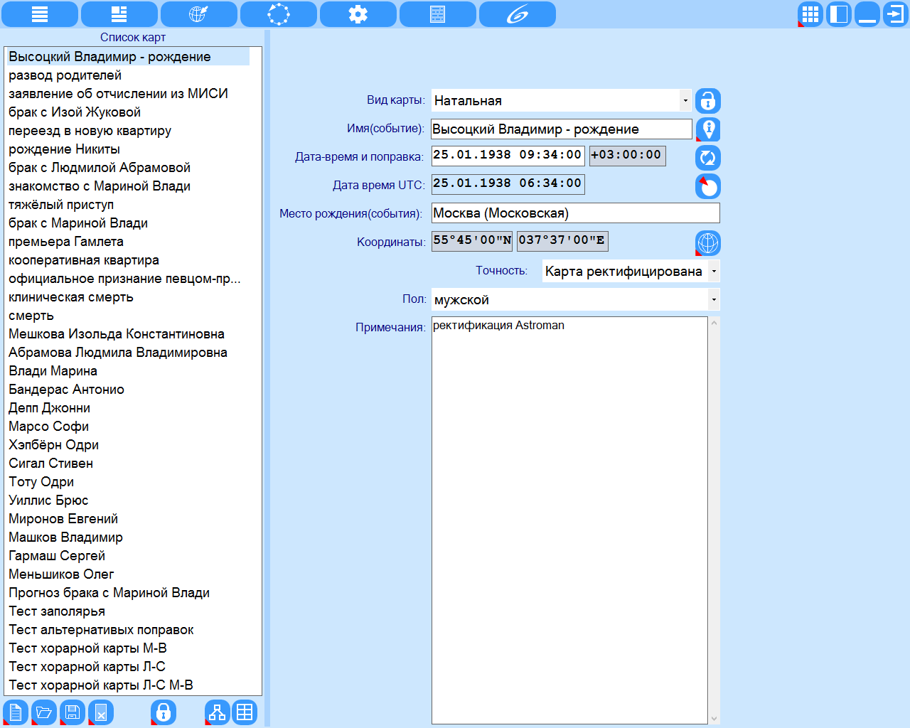
The data entry screen. List of charts is much easier to work with the charts, allowing you to create (download) a plurality of charts for the total consideration or comparison. |
|
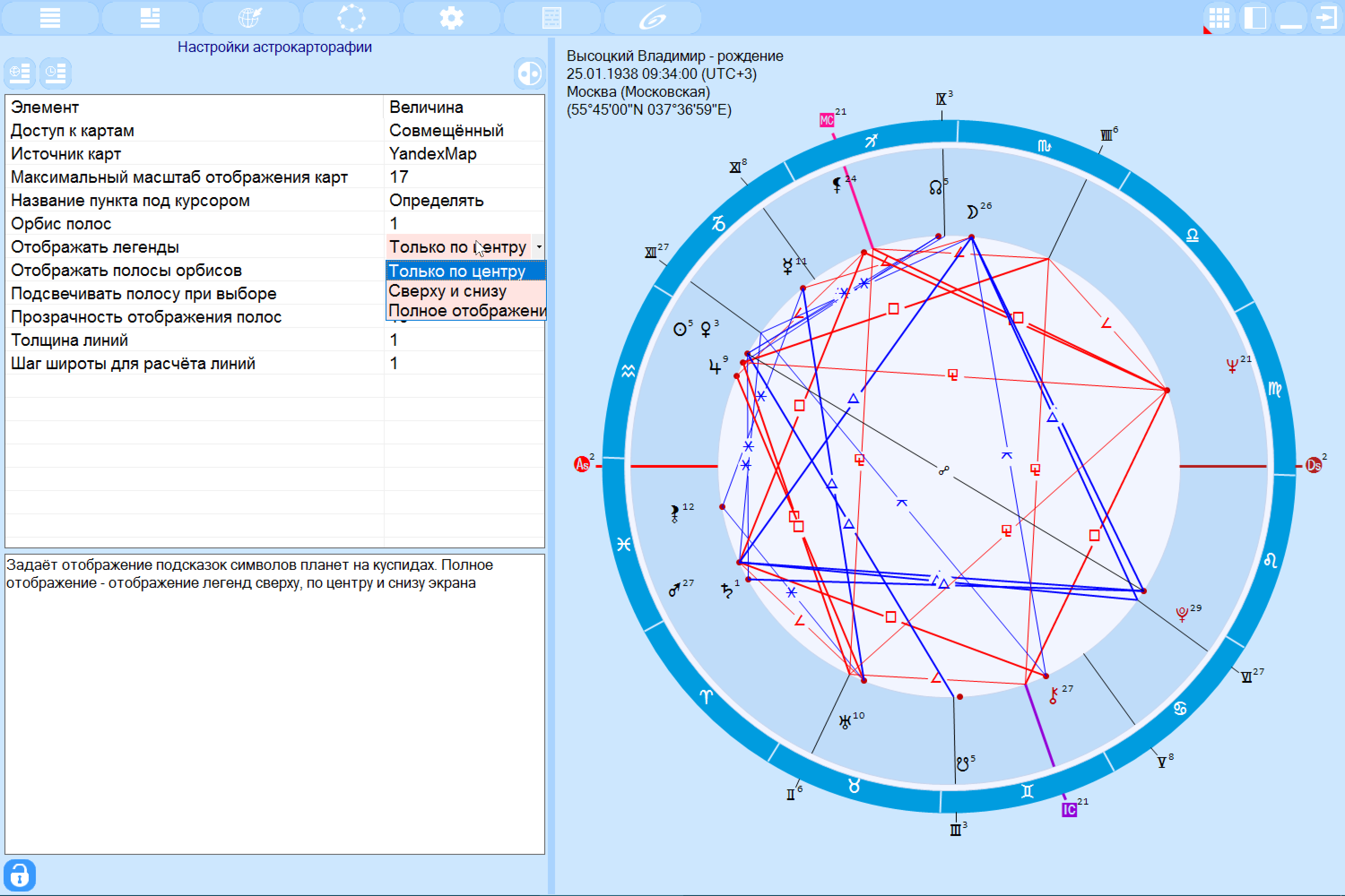
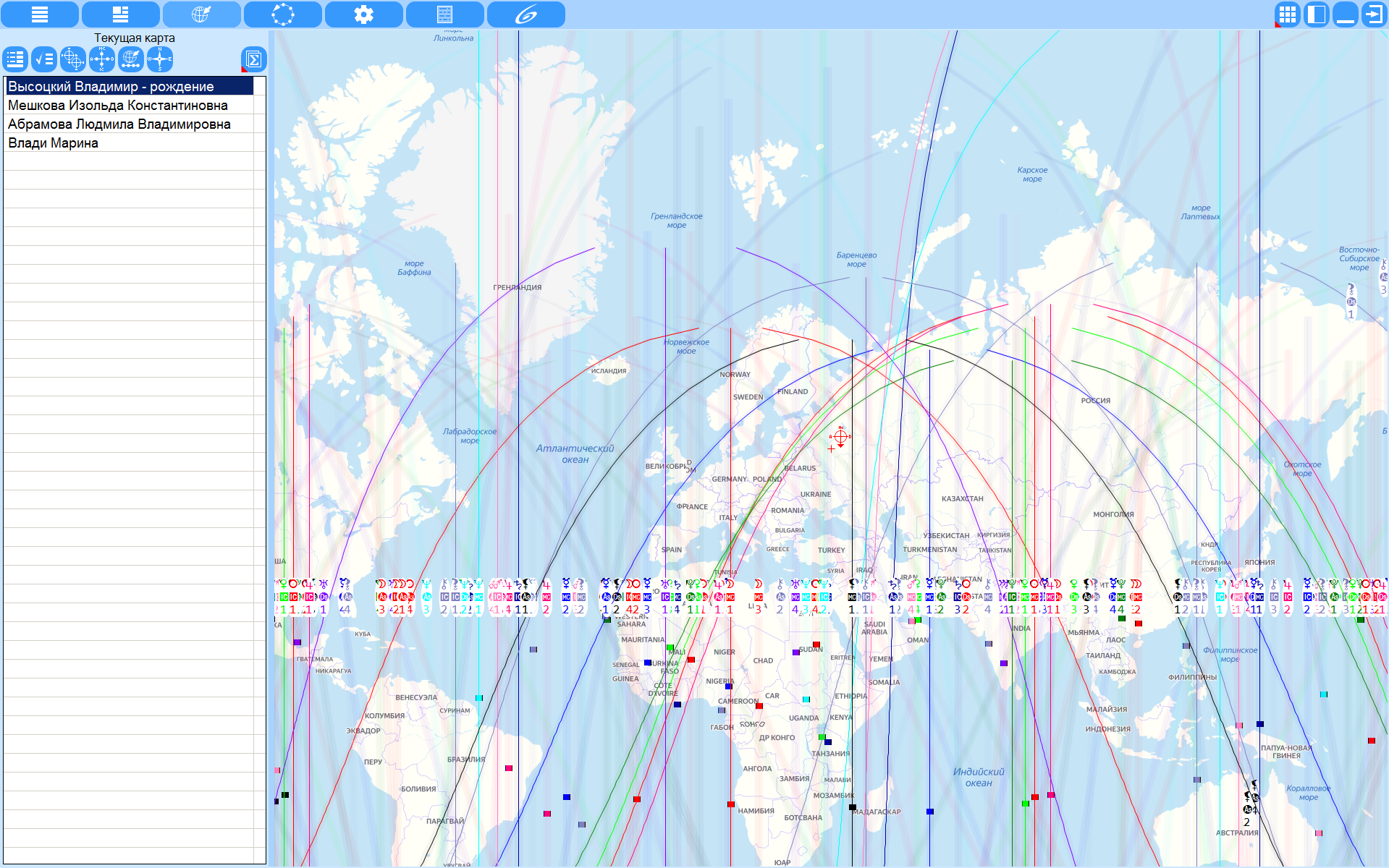
Astrocardography settings. Allow you to choose the type of maps displayed, the scale, the reaction of the map to the actions of the astrologer and much more. To change the settings, just click the lock button in the lower left corner and double-click on the desired setting. The program operates on the following groups of maps:
|
|
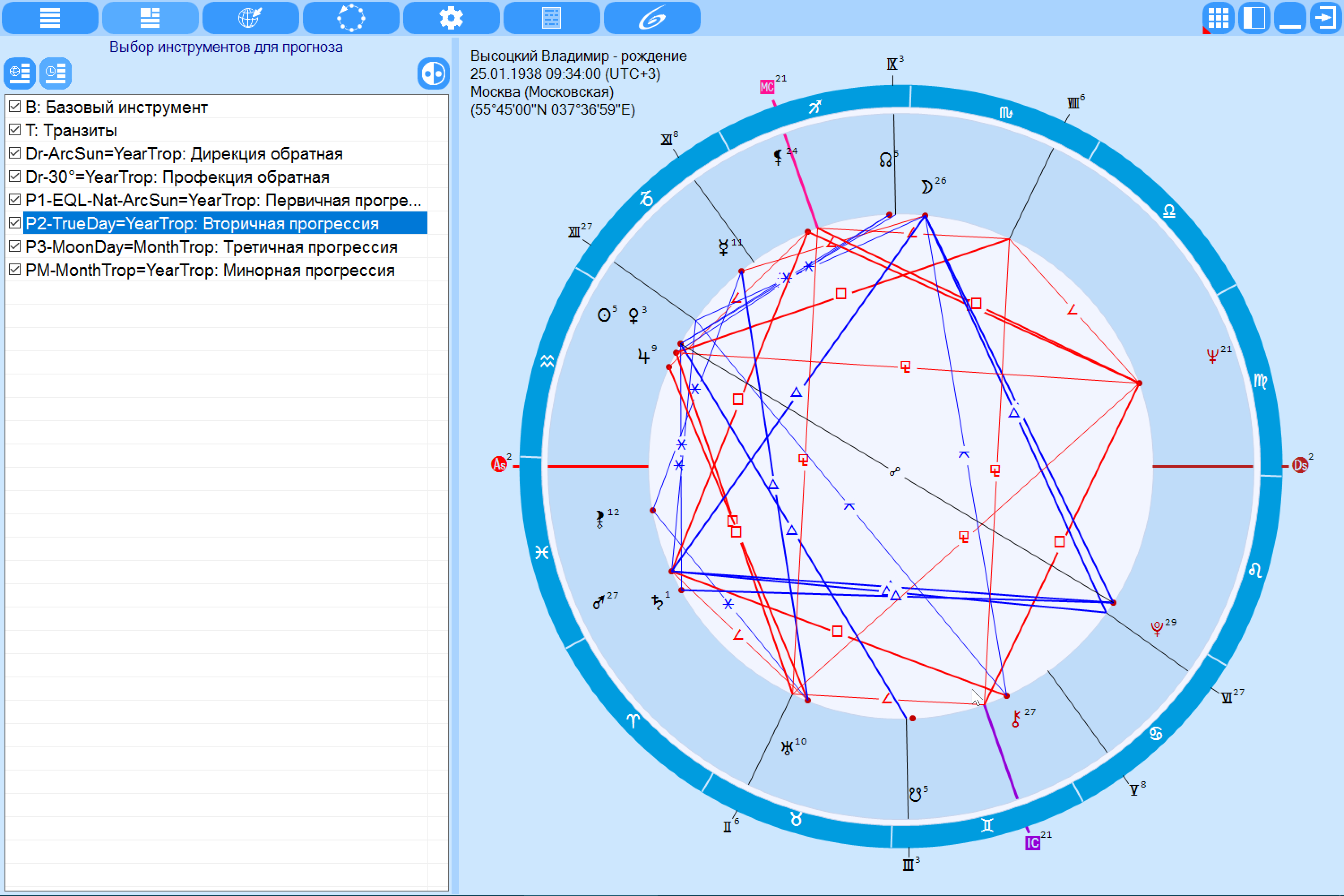
Selection of tools for forecasting. Allows you to select astrological tools to calculate the forecast cycle to get an answer to the question "When an event can be activated". |
|
Program operation modes: There are 2 operating modes available for working with astrocartography:
|

|
Work with astrocartography - Selection of objects on cusps. Selecting objects on the cusps allows you to display only the necessary combinations of planet-angular cuspid pairs to unload the map on small scales. When you change the scale of the legend map (the hints are always accompanied by the lines of the object-cuspid, and when you hover the cursor on the line, it is highlighted and a tooltip appears on the line. |
|
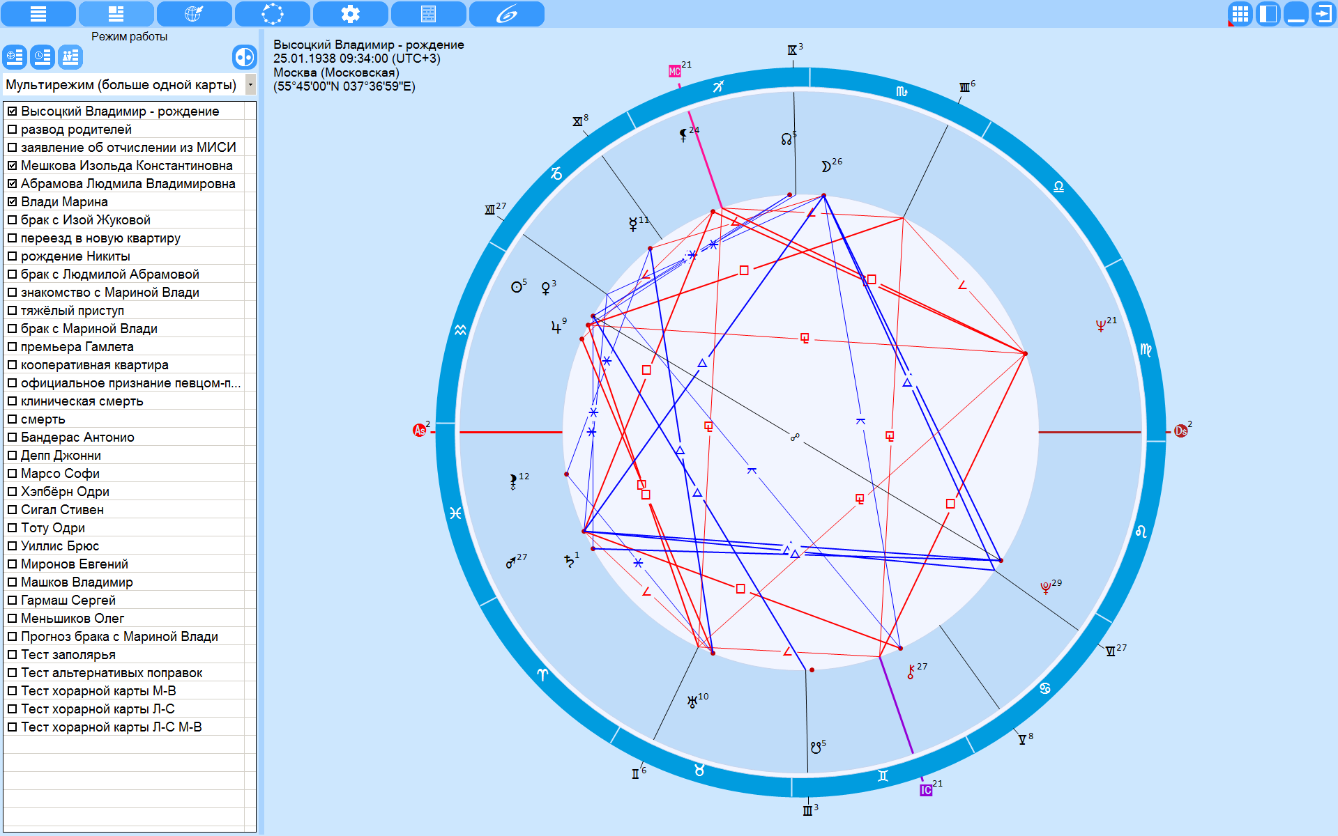
Multi-mode in GeoPort. Multimode is a unique operating mode of the GeoPort program that allows you to simultaneously display on a map lines of conjunctions of angular cusps with planets for several selected charts, which makes it easy to select and evaluate a relocation place for a group of people or the whole family. |
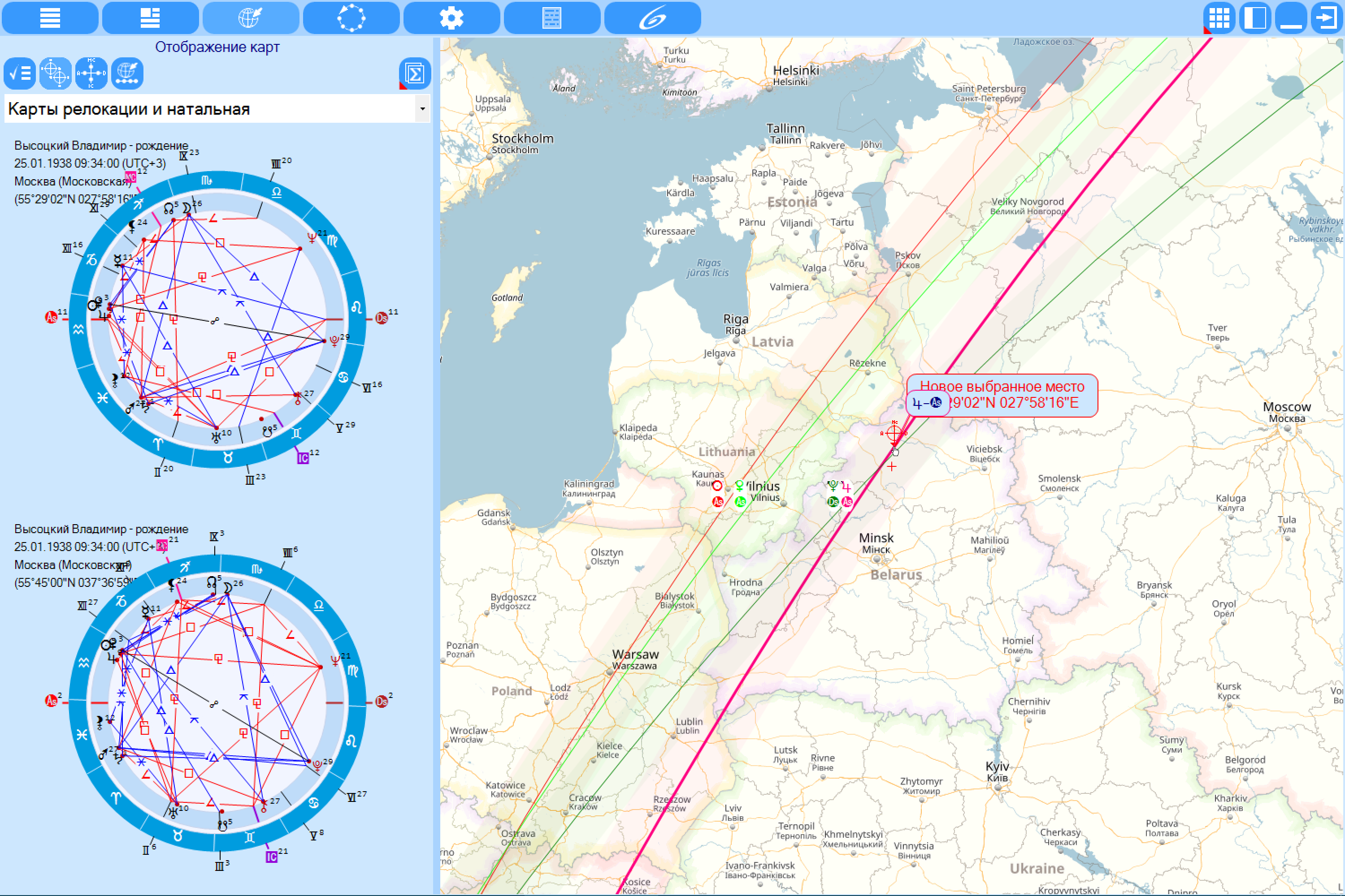
|
In this mode, you can display various combinations:
As the scale of the map increases, the line of the line's orbis becomes visible, which can be set in the settings. |
|
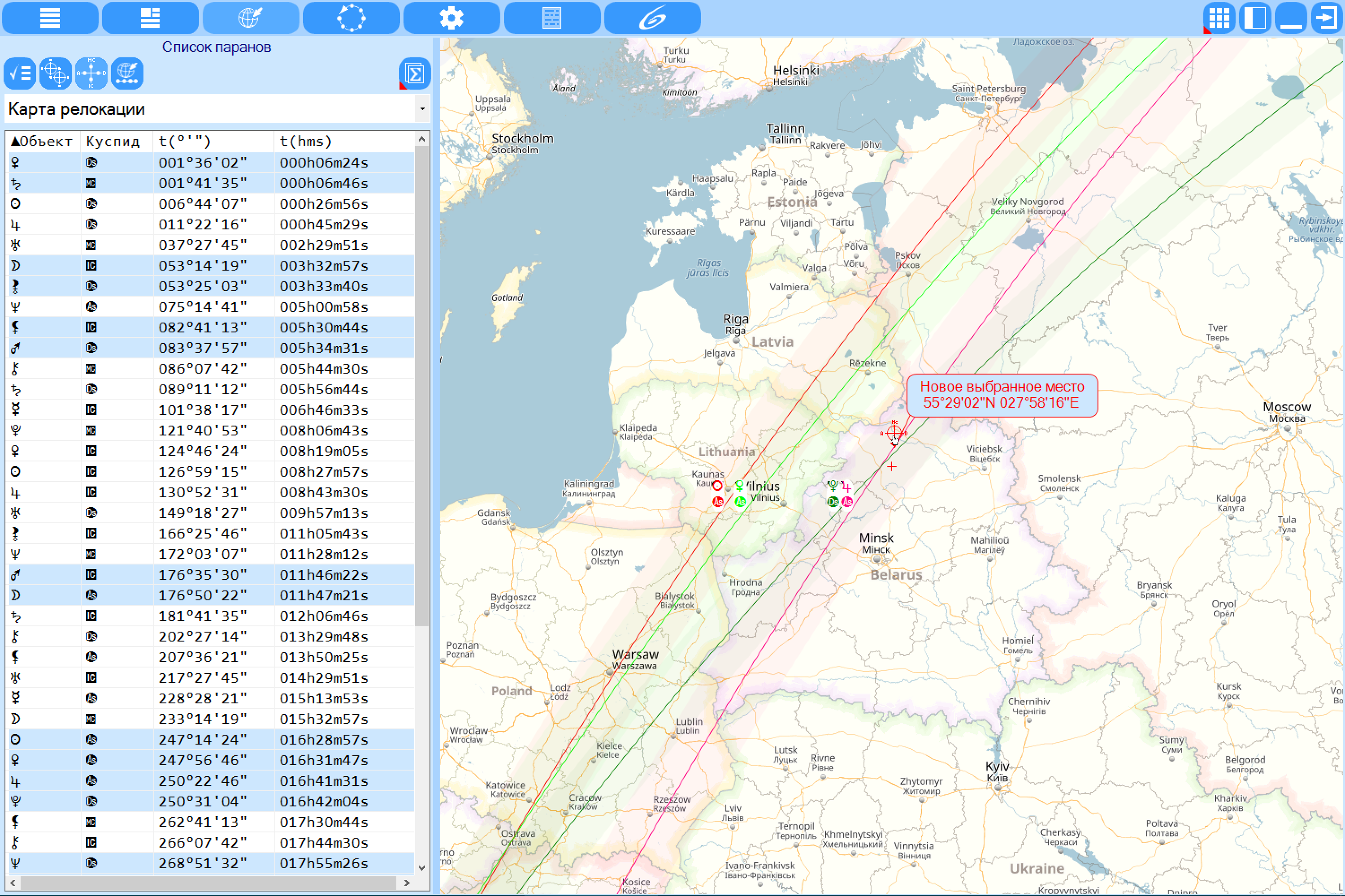
Work with astrocartography - List of paranes. In this mode, you can easily get a list of parans:
|
|
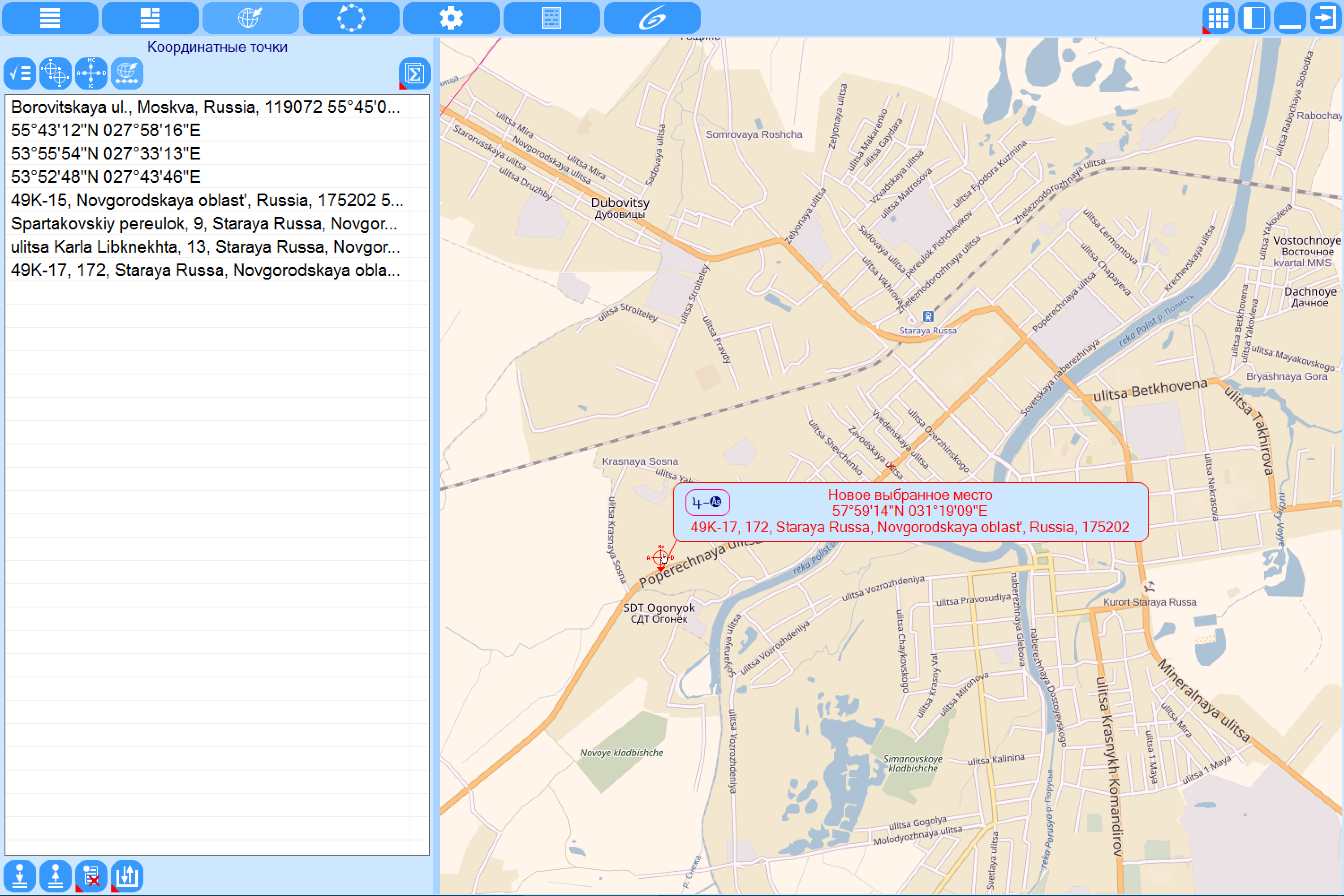
Work with astrocartography - Coordinate points. The mechanism of coordinate points allows you to quickly return to the specified (previously saved) location of relocation, which greatly facilitates the consideration and comparison of several places on the map. Coordinate point lists can be saved for further work. When you click on the map, you can get enough detailed information on the point up to the postal address, which allows you to find the necessary places for relocation to the house. |
|
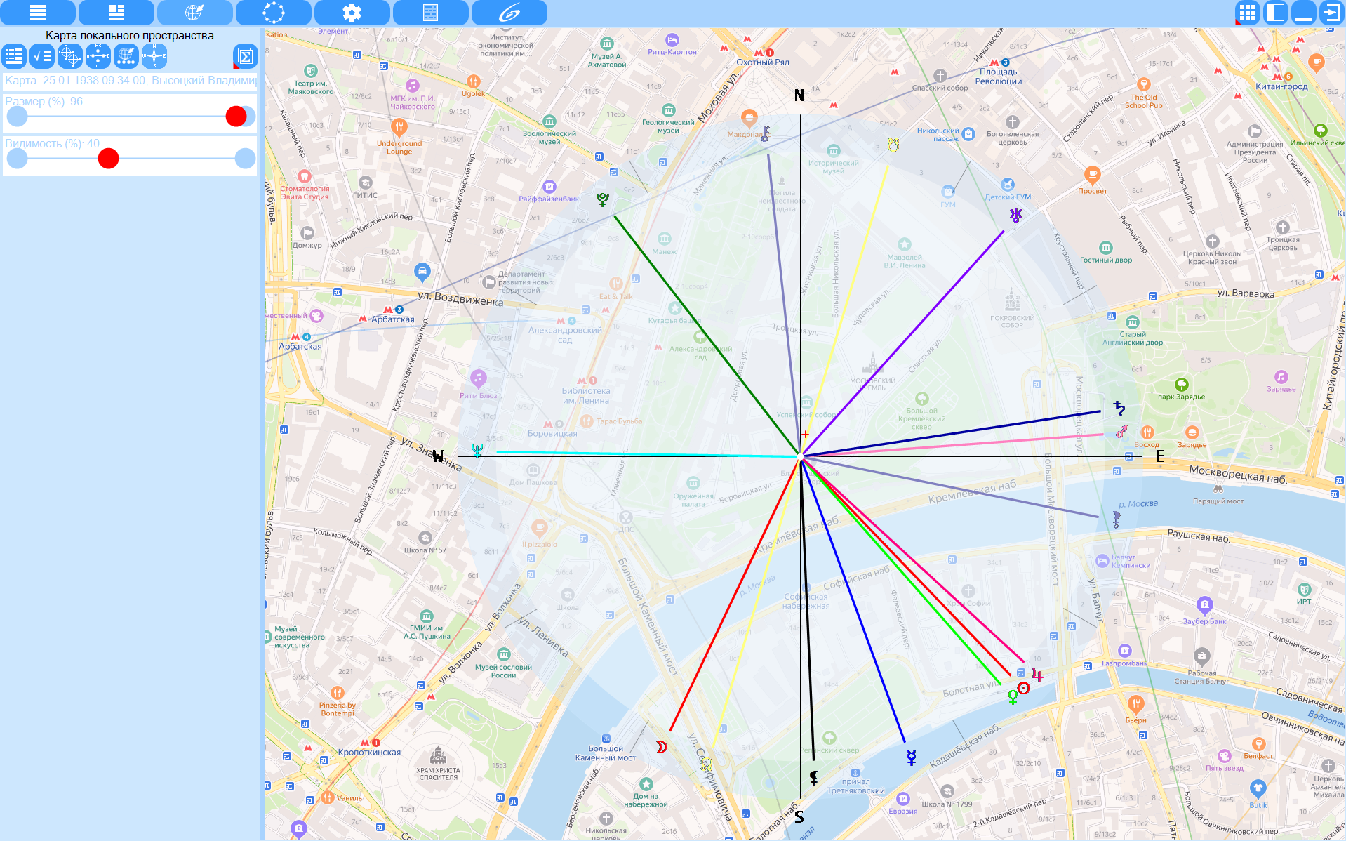
LocalSpace Map. In this mode, you can display a map of the local space (LocalSpace), built in a horizontal coordinate system to the relocated (indicated on the map) location. The brightness and size of the local space map display are regulated by elements, which greatly facilitates its perception. |
|
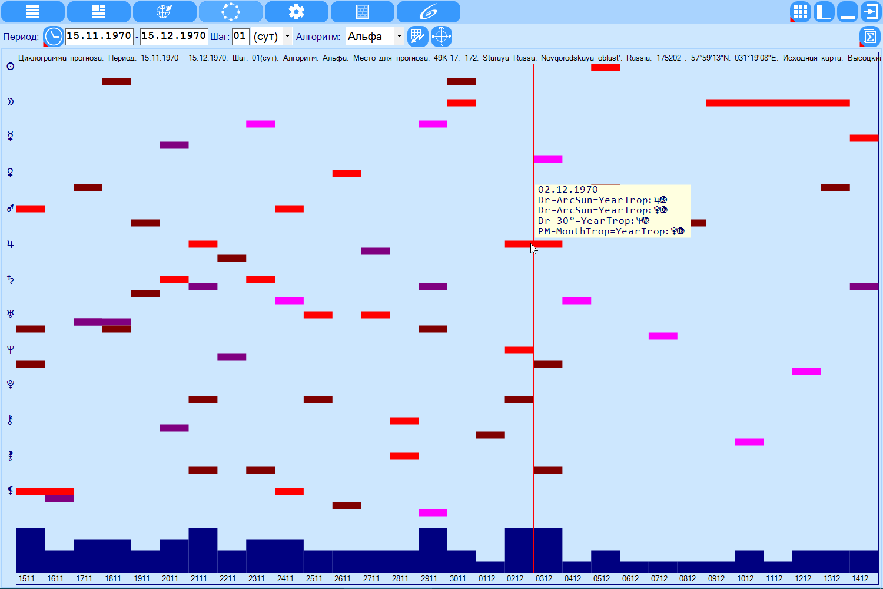
Forecast cyclogramm. Allows you to answer the question "When" can activate the map in the place of relocation. The cyclogram allows you to display the planet-cuspid pairs in the time period under consideration with a given step. In this case, the angular cusps are displayed in the same colors as in the natal chart, which greatly facilitates the perception of information. Since each planet can be on one of the 4 angled cusps at the same time for the same astrological instrument, then certain places are allocated for them. The chart at the bottom of the chart shows the total number of pairs positions at the selected point. The more these pairs are for a given time point, The greater the moment of time. This can indirectly answer the question "When". With a double click around the crosshair, you can get detailed information on the selected date - with which astrological tool at a given point which of the planets hits the corner cusp, which allows you to comprehensively assess the impact of the selected date at the time the event occurred. |
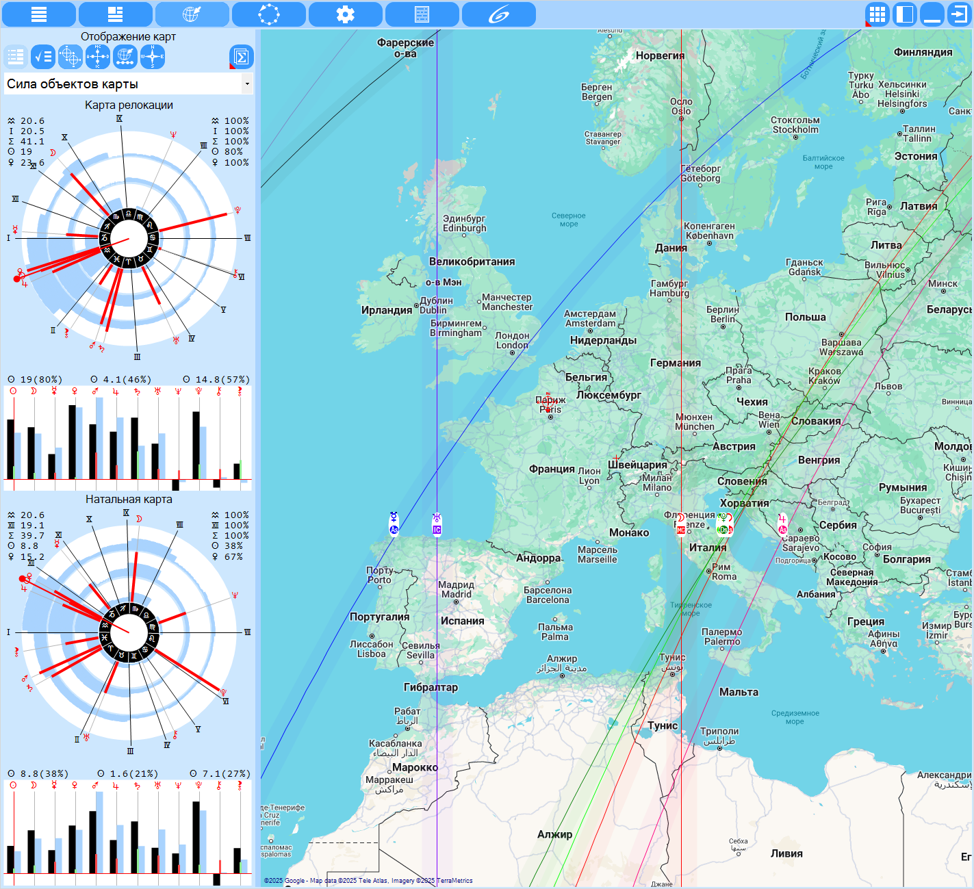
| Strength of chart objects. The analysis of the strength of chart objects allows one to perform aphetic analysis of two charts (relocation and natal) and to estimate the strength of the effect of relocation. This mode is available on condition that you purchased the module `Natal Chart Analyzer` for the ChartAnalyzer program. |
Load (download) resources for Astrological program
- Promo clip GeoPort - AstroCartography in Astrology
- Video-instruction for work with GeoPort
- Video-instruction for work with GeoPort. Part 2 - new features
- Video-instruction for work with GeoPort. Part 3 - new features
- Galaxy programs - new features. Update (20241217).
- Galaxy programs - new features. Update (20260429).
- Video-lessons on work with program elements
- Getting Started with Galaxy
- Learn Galaxy. Video lessons
- How I do it. Practical astrology lessons with Galaxy
- Videos on Galaxy astrology programs on the Internet
- Help file for GeoPort
- Databases and thematic sets
- Other Resources of site

